Here Be Dragons: Mapping Information and Imagination (2011-12)
Eric Fischer
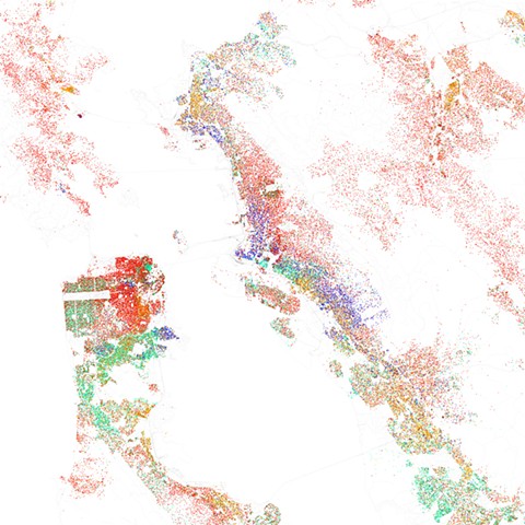
Race and ethnicity 2010: San Francisco, Oakland, Berkeley, 2011
Digital print
Maps of racial and ethnic divisions in U.S. cities, inspired by Bill Rankin’s map of Chicago, updated for Census 2010. Red is White, Blue is Black, Green is Asian, Orange is Latino, Yellow is Other, and each dot is 25 residents.
Data from U.S. Census 2010. Base map © OpenStreetMap, CC-BY-SA.
Here Be Dragons: Mapping Information and Imagination
October 21, 2011 – January 14, 2012
Intersection for the Arts
San Francisco, CA